Hikes and walks near Chalon,
Mercurey, Givry and Rully in Burgundy
Many family walks or hikes are accessible without taking the car, in a loop starting and finishing at the cottages. The list given below is not exhaustive and many variations are possible. It is easy to orient yourself and estimate distances in our Burgundy hills which are “human-sized”. We will be happy to provide you with advice and descriptions.
This article from the Journal de Saône et Loire will give you an idea of the atmosphere of our valley: " "la vallée des Vaux: un monde à part".


We provide our guests with:
 3 IGN maps : 3025 (Beaune-Chagny), 3026 (Chalon-sur-Saône) and 2926 (Ecuisses),
- 2 local hiking guides with a description and route maps, each covering 27 walks, published by the Chalon/Givry Tourist Office:
“Guide to green walks Givry-Côte Chalonnaise”: all routes within 10 minutes by car.
“Guide to green walks South of the Côte Chalonnaise”: some routes less than 20 minutes by car.

 5 hiking guides in Saône-et-Loire :
. "Les Sentiers d'Emilie en Saône-et-Loire" (Rando Editions),
. "Burgundy on foot" (Ed. TopoGuides),
. "Le p'tit Crapahut de Saône-et-Loire" (Ed. Glénat),
. "Burgundy: the 50 most beautiful hikes" (Thomas Rettstatt - Ed. Rother)
. "Nature walks in Saône et Loire" (Nadine Bourjon)
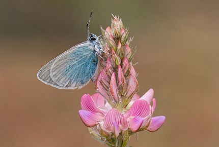
Some of the walks in the surrounding area are located on limestone grasslands, ‘pelouses calcicoles’ , protected sites with the Natura 2000 label. All the information on this label and the areas concerned can be consulted on the Natura 2000 website: Natura 2000.
Family walks (1 to 2 hours round trip from the cottages on paths and small roads):
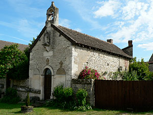
- Towards the castle of Montaigu where you can spend a little time exploring the vast ruins, go down to the hamlet of Touches and its 12th century chapel, view the Mercurey valley, return via the vineyards and the hamlet of Chamirey (6km), then go around Saint-Martin via the cemetery and return to the gîtes.
- Botanical trail and viewpoints over the Vaux valley: from the gîtes, climb towards Le Theu (large rock with breathtaking views over the Vaux valley), follow the ridge via the botanical trail (don't miss the scree just behind the 3 flower panels), descend towards the fortified farm of Blaisy, return via a small panoramic road over the valley or via the old wash house (lavoir) and the campsite of Saint-Jean de Vaux (between 5 and 7km).
- Towards Saint-Jean-de-Vaux: take the small road in the heart of the vineyards and used only by winegrowers, go alongside the campsite and the swimming pool, walk 100m on the road to the right and take the path to the left of Moulin Rossot, return towards the entrance to Saint-Jean and go down to the hamlet of La Maladière and return to Saint-Martin-sous-Montaigu (3.5 km). Route suitable for cycling with children or with strollers.
Family walks 5 minutes by car :
- Mont Avril which offers a superb 360° panorama: departure from the Jambles playground, round trip with a climb of approximately 45 minutes (3km round trip). This route can easily be combined with the “tour de Jambles” (see below). Another route is marked from the village of Cercot.
- the Agneux caves in Rully: a fun walk with a departure from the very authentic Rully chateau, chateau de Rully (très authentique), a pleasant path through a forest, then a descent with superb views on the Saône valley, and Mont-Blanc on a clear day (5km with 150m difference in altitude).
- Vallon de Mercurey : loop from the church of Mercurey, walk in the vineyards, then the forest, and visit the statue of the virgin which overlooks the valley (6-7 km). Another link for this loop around Mercurey.
Several hikes (3 to 6 hours in a loop from the cottages, with possible shortcuts or extensions):
- Chaume de Givry et Russilly (13km) : follow the GR7 from the cottages, climb the chaume (fields of stubbly sedge land) of Givry, descend towards Russilly, then after visiting the village go up to the viewpoint (statue) and return from the statue via the summit from the hill to the pass which overlooks the Vaux valley. Return via Saint Denis de Vaux and Saint Jean de Vaux (several return variants are possible). A variant, a little longer and wilder, is possible at the start via the hamlet of Etaules (which adjoins the village of Mellecey).
See on our site the shorter description, departing from St Denis de Vaux 3km away, of the loop St Denis-Russilly-St-Denis (description to print). - Tour du Montabon (12km): departure from the cottages and climb via the panoramic road to the village of St Mard de Vaux (2km), the tour du Montabon (8km), the highest point in the region, offers lovely views of the valley des Vaux and that of Dheune - return to Saint-Mard de Vaux and descend towards Saint-Martin-sous-Montaigu,
- See on our site : Le tour de Jambles and its extension to Mont Avril (description to print),
- The loop from Theurey (between Saint-Mard-de-Vaux and Barizey) : 15km to Chatel Moron and return, 5 minutes by car from the cottages.
 A curiosity: the Montagny wine trail
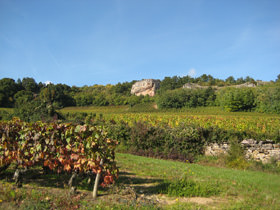
![]() 17km from the cottages, this interpretive trail offers a 4.5km loop punctuated by 8 panels allowing you to better understand the work in the vineyard and the history and richness of a wine appellation (Montagny). Beautiful views of the Côte Chalonnaise throughout this route which allows you to discover this appellation of white wines that is relatively unknown but offers very good value for money.
17km from the cottages, this interpretive trail offers a 4.5km loop punctuated by 8 panels allowing you to better understand the work in the vineyard and the history and richness of a wine appellation (Montagny). Beautiful views of the Côte Chalonnaise throughout this route which allows you to discover this appellation of white wines that is relatively unknown but offers very good value for money.
The departure is located near the communal cellar and ends with the (charming) riottes of the village, a map and route are available in our gites.
 10km from the Gites, a 7km loop (prehistoric site)
In Chassey-le-Camp, the loop passes through the prehistoric site of the Chasséens, one of the first sedentary civilizations from around 4000 BC. There is a small museum at the village ‘Mairie’ which is the starting point. There are also lovely balcony views over the Maranges valley and Santenay.
This short 2-2.5-hour hike is very varied: you also pass by the Chateau de Chamilly, flowery meadows, a very dense forest, and the hamlet of Nantoux.
Route and directions are available at: https://www.visorando.com/randonnee-chassey-le-camp-sur-les-traces-des-chass/carte-diagramme.html
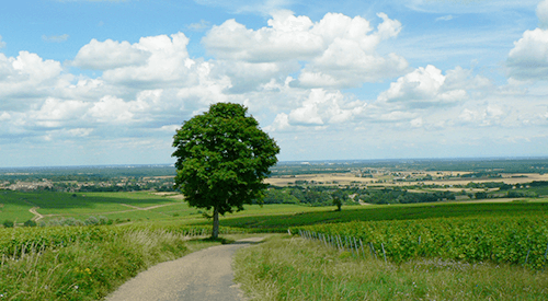
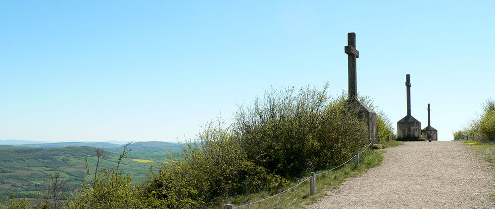
 Panorama de la vallée des Maranges, entre le Mont rome et la Montagne des 3 Croix, au-dessus de Santenay
A hike to “read” the landscape in Culles-les-Roches”

30 minutes from the gîtes, south of Buxy, the village of Culles-les-Roches is located on a geological fault. The "Géorama" hike (6km, 2h30 and 7 very well-designed panels) allows you to go around the village, viewing it from a number of different perspectives
We took a further an extension of about 1 hour 15 minutes to the top of the hill to see other landscapes and natural environments and found a few surprises!
Don't forget to take the time to stroll a little through the middle of the village near the cliff, it is charming.
See the description in our site
Link to the PDF of the route : http://tourisme-sud-cote-chalonnaise.com/wp-content/uploads/2018/01/DEPLIANT-GEORAMA.pdf

A hike with a 360° panorama
The Mountain of 3 Crosses in Santenay - This walk is very well known in the region because it culminates at an altitude of more than 500m and offers a truly circular panorama with even 2 orientation tables at the summit because there are so many points to locate. On a clear day, you can see the Mont-Blanc massif.
As this walk is a little busy (a road runs close to the summit), we do not recommend going there on a Sunday or public holiday.
Be careful as there is very little shade on the way up to the summit.
We recommend parking at the Santenay casino and following the route https://www.beaune-tourisme.fr/que-faire/idees-de-circuits/circuit-n-26-circuit-des-cretes-617630 (3h30 for 10.6km).
Several options are possible to shorten the route after the summit.
At the end of the descent, before returning to Santenay le Haut, don't miss the view of the Santenay windmill opposite (you can make a detour there of around 20 minutes, depending on how tired you are...).
Another loop in the Maranges valley near Santenay
https://www.achalon.com/a-voir-a-faire/itineraires/randonnee-dans-les-maranges-4835892
Some links to find out more about nature reserves in Burgundy:
Conservatoire d'Espace Naturels en Bourgogne
Sites Natura 2000 autour de Chalon (pelouses calcicoles)
Cycling routes
Several routes are possible from the cottages on small, quiet roads, some are a little hilly (but not too much).
- The tour of Mercurey
- The tour of the Vaux Valley
- The Mercurey and Rully château loop
- The large loop of the Canal du Centre
- The access path to the Voie Verte passing by the Chateau de Germolles
- The Santenay-Nolay-Bout du monde cycle path
- The Santenay-Beaune cycle route
You will find all the information and details on our page “A week of cycling and tourism in Burgundy”. "A week of cycling and tourism".